Australia Braces for Early Cyclone Risk Amid Record Warm Seas, Widespread Storms Forecasted
November 14, 2025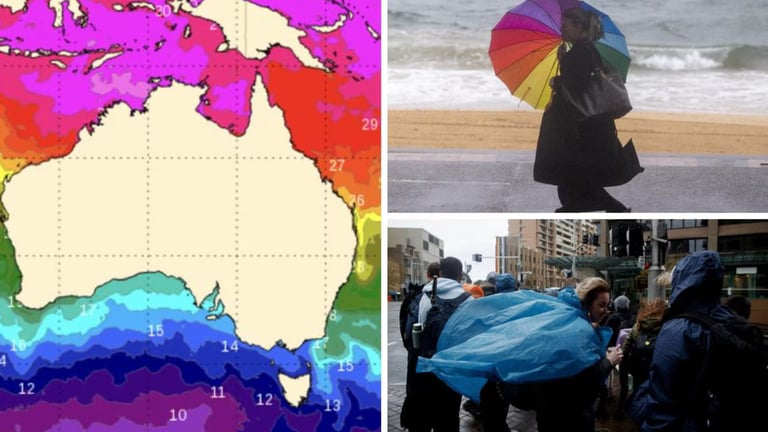
The Bureau of Meteorology says the tropical low currently has only a low chance of becoming a tropical cyclone around or after next Tuesday, with development dependent on specific atmospheric conditions.
Sydney is unlikely to experience storms, while Melbourne and Hobart are expected to stay cooler and unsettled with showers through the weekend; Adelaide may see afternoon thunderstorms, Perth should be sunny with light winds, and Darwin faces a hot day with a high chance of showers and a thunderstorm near 33C.
A tropical low named 02U north of the Kimberley is developing and could move into the Timor Sea early next week, potentially marking Australia’s first tropical cyclone of the season.
Brisbane, the Gold Coast, the Sunshine Coast, and parts of NSW’s Northern Rivers and Sydney region are set for intensified storm activity over the weekend, with some areas facing non-severe conditions.
Across eastern and southern Australia, widespread potentially severe weather is forecast, including thunderstorms, large hail, and damaging winds from Queensland and NSW down to the Hunter Valley, Blue Mountains, and coastlines of South Australia and Victoria.
Sea surface temperatures have surged above 31C, well past the 26.5C threshold for cyclone formation, with warm waters northwest of Darwin among the top 10% of historical records for this time of year, signaling the ocean is primed for development in the coming weeks.
The story centers on an early-season Tropical cyclone risk linked to record warm sea temperatures, with a broad forecast of stormy weather across multiple Australian states in the coming days.
Summary based on 1 source
Get a daily email with more Climate change stories
Source

news.com.au — Australia’s leading news site for latest headlines • Nov 13, 2025
‘Blob’ sparks tropical cyclone fears