NASA's CYGNSS Revolutionizes Disaster Forecasting with Satellite GPS Reflections
July 3, 2026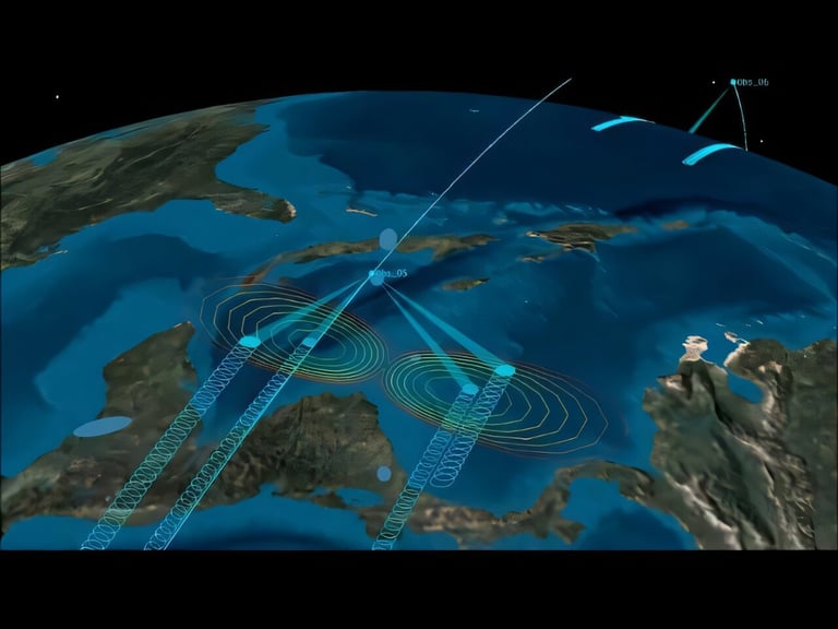

The mission demonstrated that GNSS-R (Global Navigation Satellite System reflectometry) can use reflected GPS signals to monitor droughts, wildfires, floods, soil moisture, and even locust infestations, leading to a new constellation-based approach to earth observation.
CYGNSS, a NASA mission launched in 2016 by the University of Michigan, used GNSS-R to detect GPS signals reflected off the Earth, initially to improve hurricane forecasting but later proving valuable for land applications like soil moisture, drought, floods, wildfires, and locust forecasting.
Eight-satellite constellation samples the same ground point about every seven hours, enabling imaging of storm eyes for a larger portion of a storm’s lifetime than previous systems.
FireSat and related GNSS-R efforts aim to predict wildfire risk and spread, with FireSat recognized as Time’s Best Inventions of 2025 and ongoing CALFIRE collaborations for fire behavior forecasting.
Key figures include Chris Ruf and Aaron Ridley, whose collaboration helped pivot GNSS-R from ocean focus to land and flood/wildfire applications; Clara Chew leads GNSS-R data at Muon Space.
CYGNSS data improved NOAA hurricane forecasts and spurred private-public collaborations, with NOAA licensing IP to Muon Space for commercial use and attracting international interest.
Notable outcomes include better forecasts of storm intensity, track, size, and precipitation, plus practical fire-size and risk predictions that aid firefighting planning.
The concept has evolved to support broader disaster management, drone-based sensing, and faster data delivery, signaling ongoing growth of GNSS-R technology.
The constellation demonstrated that cheap, small satellites can provide high-temporal data by receiving reflected GPS signals from multiple directions, enabling near-daily coverage of the tropical storm belt.
A growing ecosystem of GNSS-R systems now includes ten similar deployments by governments and companies, with FireSat as a notable example expanding drought, wildfire, flood, and locust monitoring.
A pivot toward a cheaper, distributed constellation model emerged after an original project’s failure, showing how multiple small satellites can overcome coverage limits of single-satellite sensors.
Future enhancements include receivers that detect more GPS reflections per second and potential data routing through Starlink to speed real-time data delivery, expanding practical use.
Summary based on 3 sources
Get a daily email with more Science stories
Sources

Michigan Engineering News • Jul 1, 2026
This satellite constellation transformed earth science by creatively tuning in to GPS signals