Space Force Ensures Artemis II Safety with Extensive Hazard Zone Mapping and Emergency Coordination
April 4, 2026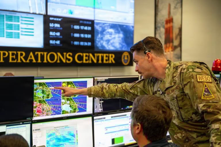
The U.S. Space Force's Space Launch Delta 45 at Patrick Space Force Base analyzed payloads, launch vehicles, and trajectories for NASA's Artemis II to identify hazard zones that must be avoided by land, sea, and air.
SLD 45's Office of Emergency Management planned and coordinated emergency response measures with state and local authorities, including roadblocks, traffic flow, and emergency vehicle positions in case of an anomaly.
An official emergency operations center overseen by the Office of Emergency Management monitored the launch to rapidly disseminate information and directions due to the volatile nature of spaceflight.
Space Force leaders noted that SLD 45’s oversight of the Eastern Range enabled more than 100 launches in 2025 and aim to sustain a higher launch tempo, underscoring safety and readiness as critical.
The 1st Range Operations Squadron and the 45th Weather Squadron analyzed telemetry and weather conditions to ensure a safe rollout and ascent, while the 45th Logistics Readiness Squadron supported the Air Force Detachment 3’s spaceflight recovery team with airfield logistics.
The Artemis II spacecraft Orion, carrying four astronauts, traveled at about 3,700 miles per hour and was roughly 150,000 miles from the Moon and 100,000 miles from Earth as of Friday afternoon per NASA’s mission tracker.
The hazard zones were established through extensive trajectory and debris analysis and required cross-agency coordination to protect people and equipment near Cape Canaveral Space Force Station.
Summary based on 1 source
Get a daily email with more Space News stories
Source

Military Times • Apr 3, 2026
How the Space Force guaranteed a safe Artemis II launch