NISAR Satellite Unveils First Detailed Radar Images of U.S. Landscapes Ahead of November Science Launch
September 25, 2025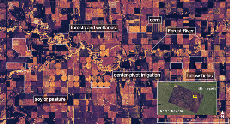
Positioned in a near-polar orbit approximately 464 miles above Earth, NISAR utilizes advanced synthetic aperture radar technology developed through a collaboration between NASA and ISRO, the Indian Space Research Organization.
NISAR also carries an S-band radar, capable of detecting small vegetation, which is useful for monitoring agricultural and grassland ecosystems, making it the first spacecraft to carry both L- and S-band radars.
The satellite's L-band radar can resolve objects as small as 15 feet, allowing for detailed monitoring of natural features and human-made structures, and can penetrate forest canopies to measure soil moisture and ground movement.
Launched from India two months ago, NISAR is part of a $1.3 billion joint U.S.-Indian mission designed to survey land and ice masses globally multiple times, providing critical data for understanding climate change impacts and natural hazard management.
NISAR's global surveying will help track slight shifts in land and ice, supporting natural hazard management and climate change studies.
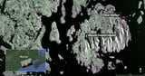
NASA's new Earth-mapping satellite, NISAR, has released its first radar images, showcasing detailed views of the Maine coast and North Dakota farmland, as a preview of the data expected once science operations begin in November.
The mission aims to monitor subtle shifts in land and ice, aiding forecasters and first responders in managing natural disasters such as floods, landslides, and volcanic eruptions.
The project exemplifies international collaboration, with key contributions from NASA's Jet Propulsion Laboratory, Caltech, and India's Space Applications Centre, building on a longstanding U.S.-India space partnership.
These initial images serve as a preview of NISAR's capabilities, with further data expected to enhance disaster response and environmental monitoring by tracking subtle shifts in land and ice.
Scheduled to begin its science phase in November 2025, NISAR's data will support understanding Earth's changing land, ice, and ecosystems, assisting in disaster response, infrastructure monitoring, and agricultural management.
Orbiting at approximately 464 miles (747 kilometers), NISAR will monitor Earth's land and ice surfaces twice every 12 days, providing vital data on land changes, ice dynamics, and natural disasters.
The captured images, taken by NISAR's L-band radar, show features like Maine's Mount Desert Island, with green indicating forests and magenta representing harder surfaces such as bare ground and buildings.
Summary based on 6 sources
Get a daily email with more Science stories
Sources

Yahoo News • Sep 25, 2025
First radar images from new Earth-mapping satellite showcase Maine coast and Minnesota farmland
AP News • Sep 25, 2025
New Earth-mapping satellite releases first radar images | AP News
NASA Jet Propulsion Laboratory (JPL) • Sep 25, 2025
NASA-ISRO Satellite Sends First Radar Images of Earth’s Surface