Experts Urge Satellite Monitoring for Glacier-Rock Collapse Warnings After Nepal-Tibet Tragedy Kills Thousands
September 2, 2026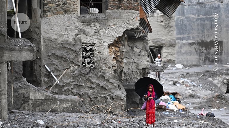


Existing warning systems are limited for glacier–rock collapses; while regional efforts like Cirenmaco glacial lake monitoring in Tibet and Khumbu sensors in Nepal track related variables, there is no widely deployed regional satellite-based system that routinely detects accelerating deformation in glacier–rock systems and links it to downstream hazard modelling.
Researchers rapidly mobilized to investigate the disaster, using satellite imagery, drone surveys, and modeling to understand causes and reconstruct the sequence of events leading to fatalities and damage.
Critical uncertainties remain about the exact trigger, the source and volume of floodwater, and the flood front velocity, requiring further analysis to reconcile different estimates.
A catastrophic glacier-ice and rock avalanche near Langtang Lirung peak in Nepal triggered a deadly flood, killing or missing thousands, with about 1,100 confirmed deaths and around 4,000 missing as of the report.
The Langtang Lirung collapse on August 26 set off a cascading hazard chain, forming two new lakes and sending destruction downstream across Nepal for up to 100 kilometers.
The disaster recalls the 2021 Chamoli flood in Uttarakhand but involved a much larger glacier area and mass, resulting in roughly 1,000 deaths confirmed with hundreds more missing and widespread damage along Bhote Koshi and Trishuli rivers.
Experts emphasize that acceleration of movement, not just velocity, is crucial for early warning; SAR data can pre-screen at-risk areas, but effective warnings require integrated, tailored responses combining geophysical and hydrological modeling with local terrain knowledge.
HiRISK assessments corroborate satellite observations showing meltwater and internal water flow accelerating before the avalanche, suggesting future incidents could be mitigated with AI-assisted monitoring and scalable, proactive warning systems.
The timing of the collapse remains unclear, as observed acceleration alone might not have indicated imminent collapse, but signals could have flagged the area for closer monitoring.
Analysis of Sentinel-1 data from early January to August 2026 shows slow glacier–rock movement that accelerated in the weeks before the collapse, indicating potential warning signs that were not acted upon.
Sentinel-1 data showed the glacier–rock mass moving downhill at about 10 millimeters per month, with accelerating deformation near the failure zone in the days before the disaster.
Discussions on climate-change implications highlighted Himalayan ecosystem vulnerability and the push for international cooperation, with Nepal pursuing climate-related compensation through UNFCCC and the Paris Agreement rather than bilateral claims.
Summary based on 4 sources