Google Maps Unveils Stark Imagery of Gaza's Devastation Post-Conflict
September 28, 2026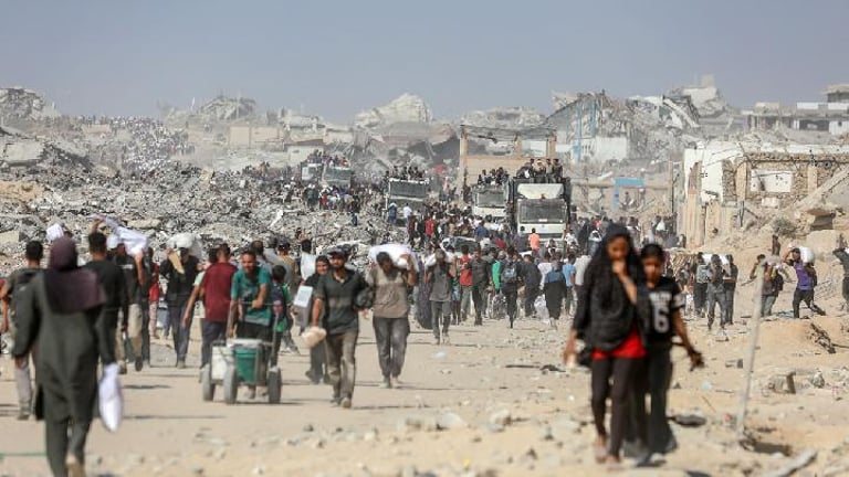


Google Maps and Google Earth imagery now show extensive destruction across Gaza, including Gaza City, Khan Younis, and Rafah.
Despite a ceasefire since late 2025, persistent structural weaknesses have caused collapses during rain and high winds, keeping displacement high due to shelter shortages and limits on temporary housing.
Health authorities say more than 74,000 Palestinians have been killed and over 175,000 injured since the conflict began, with about 90% of critical infrastructure damaged or destroyed.
Social media reactions underscore the stark clarity and impact of the imagery, with analysts and journalists noting the map reflects the scale of destruction.
The imagery shows entire urban blocks and landmarks wiped out, major roads still visible but surrounding areas turned to debris and makeshift shelters.
UNOSAT data through mid-2026 counts about 201,290 structures damaged in Gaza, roughly 82% of buildings, including 134,422 destroyed and thousands more severely, moderately, or possibly damaged, totaling about 328,627 damaged housing units.
Google hasn’t disclosed exact capture dates for all updated tiles, but the imagery represents the clearest publicly available view of Gaza’s altered landscape to date.
Summary based on 1 source
Get a daily email with more World News stories
Source
TEMPO.CO • Sep 28, 2026
Google Maps Updates Reveal Widespread Gaza Damage