Two-Thirds of U.S. Urban Land Sinking, Study Warns of Infrastructure Risks
May 8, 2025
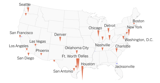
A recent study published in the journal Nature reveals that nearly two-thirds of the land in 25 out of 28 U.S. cities is affected by subsidence, with major urban centers like Houston and New York already facing significant infrastructure vulnerabilities and heightened flood risks.
Utilizing satellite-based radar measurements, the study provides high-resolution mapping of subsidence, identifying groundwater extraction as a primary cause due to urban centers' excessive demand for freshwater from aquifers.
While subsidence rates may seem minimal, they can significantly impact the structural integrity of buildings, roads, and other infrastructure over time.
Despite the alarming findings, researchers assert that solutions are feasible, including land raising, improved drainage systems, and stricter building codes to protect infrastructure and residents.
Shirzaei warns that the gradual nature of subsidence can lead to severe structural issues becoming apparent only when damage reaches a critical point.
Detailed mapping of soil movement can aid in policy development and enhance groundwater management and urban planning to minimize risks associated with subsidence.
The findings underscore that ongoing subsidence will exacerbate the impacts of climate change, particularly in coastal and flood-prone regions, as sinking land combined with rising sea levels increases flood risks.
Shirzaei concludes that subsidence is a solvable issue, primarily driven by human activities, and emphasizes the need for improved monitoring and responsible urban development to safeguard cities for future generations.
The research aims to equip experts and policymakers with a framework to monitor subsidence and develop effective mitigation strategies.
The study highlights specific hotspots of risk, enabling targeted interventions to strengthen infrastructure and enforce building codes in vulnerable areas.
Manoochehr Shirzaei, a co-author of the study, likens their methodology to a CAT scan of the Earth's surface, allowing for precise identification of ground movement crucial for urban planning and flood risk management.
The authors advocate for integrating land subsidence monitoring into urban planning, recommending proactive measures such as flood mitigation and retrofitting at-risk structures.
Summary based on 27 sources
Get a daily email with more US News stories
Sources
The New York Times • May 8, 2025
Groundwater Pumping Is Contributing to the Sinking of Major U.S. Cities
Business Insider • May 8, 2025
Biggest US cities are sinking, including New York, Chicago, Dallas
The Washington Post • May 8, 2025
Land under the country’s largest cities is sinking. Here’s where — and why.