Hektoria Glacier's Sudden Collapse Signals Faster Antarctic Retreat, Sea-Level Rise Concerns
November 3, 2025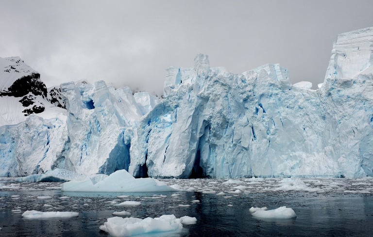
The rapid retreat of Hektoria Glacier was driven by its floating on a flat bedrock ice plain beneath sea level, allowing thinning to bring the ice to flotation and triggering a surge of calving.
Multiple grounding lines and an ice-plain topography meant the glacier could go afloat, exposing it to ocean forces that opened crevasses from both the bottom and top and accelerated disintegration.
Key researchers include Naomi Ochwat and Ted Scambos, with the study outlining either an extreme end-member scenario or a broader risk recipe depending on context.
The debate reflects a wider consensus that polar regions are changing rapidly with warming, underscoring the need for more satellite data to clarify mechanisms and regional sea-level risks.
The 2022 collapse began after coastal sea ice vanished, removing support and setting off a cascade of calving and rapid thinning not seen at this speed before.
Scambos noted that the findings broaden understanding of grounding-line dynamics and floating ice, underscoring potential acceleration of sea-level rise if similar processes occur elsewhere.
Recognizing ice-plain topographies across Antarctica could improve forecasts of rapid retreats and help monitor vulnerable glaciers for future sea-level impact.
Experts say the finding raises the bar for how quickly Antarctic glaciers can retreat, highlighting ongoing uncertainties in projecting future sea-level rise.
There is scientific debate about the precise grounding of Hektoria due to differing satellite interpretations, with some contesting a buoyancy-driven collapse explanation.
Ochwat emphasized that high-frequency, multi-source satellite data captured two and a half kilometers of ice loss in two days, a rate that sparse imaging would miss.
Findings may help identify other tidewater glaciers with similar topography that could undergo rapid retreat, informing sea-level rise projections and monitoring priorities.
The team showed about 2.5 kilometers of ice loss in two days, illustrating the importance of combining multiple satellite datasets to fill time gaps.
Summary based on 7 sources
Get a daily email with more World News stories
Sources
BBC News • Nov 3, 2025
Rapid Antarctic glacier retreat sparks scientific 'whodunnit'
New Scientist • Nov 3, 2025
Antarctic glacier's alarming retreat is the fastest ever seen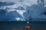
Phys.org • Nov 3, 2025
Antarctic glacier retreats faster than any other in modern history, findings show